Ondangwa
Ondangwa (earlier spelling Ondangua) is a town in the Oshana Region of northern Namibia, bordering the Oshikoto Region. Ondangwa was first established as a mission station of the Finnish Missionary Society (the FMS) in 1890. In 1914, it became a local seat of government.
Ondangwa is said to mean the end of the Ondonga area. (Ondonga is one of the kingdoms of Ovamboland), and Ondangwa is located on the western edge of this kingdom.
Ondangwa is located about 60 km from the Angolan border, along the B1 road. It is one of the places of residence of the Kings of Ondonga; the current King Eliphas Kauluma, father to the reigning king, lives here. Most of the residents of the town speak Oshindonga.
Ondangwa is the district capital of the Ondangwa electoral constituency.
Ondangwa features various shopping centre, a large open market, and several tourism facilities. There are also shopping centres such as Gwashamba mall, Yetu complex, Ondangwa Industrial Park, Time Square Mall, Sun Square mall, Andimba Toivo yaToivo Complex, Three Sisters Mall and others. Many local authorities for the Oshana and Oshikoto regions are seated in the town, e.g. the Ministry of Education and Police. Onandjokwe State Hospital is situated nearby.
Ondangwa remains an important transit point for Owambo contract workers going to or coming from the copper- and lead-mining town of Tsumeb, 270 km southeast.
There are several schools in the town, among them Andimba Toivo ya Toivo Senior Secondary School. Some schools extend far from the town - for instance Ekulo Senior Secondary School.In terms of education, there are many schools in Ondangwa such as Heroes Private School, Nangolo Secondary School, Iihenda Secondary School and Ondangwa Secondary School. There are also primary schools such as Olukolo Primary School and Ondangwa Prof-Private School and many other. Apart from schools that offer full time classes, there are also schools which offer part time classes to learners who want to improve their grade 10 and 12 results. These are schools such as Elite and NAMCOL. NAMCOL centre also offers other programmes such as ICDL which trains students on how to use computers and other ICT skills. The most well-known football team is KK Palace and Volcano.
Since independence, the government has settled up an industry in the north, to create jobs and improve the poor infrastructure. Rössing Foundation, Kayec and Cosdec are the three vocational skills schools training young people in building maintenance, sewing, cooking, and Internet Technology.
Safland Namibia is developing a multimillion-dollar shopping mall in Ondangwa.
Map - Ondangwa
Map
Country - Namibia
 |
 |
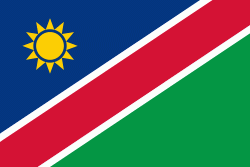
| Flag of Namibia | |
The driest country in sub-Saharan Africa, Namibia has been inhabited since pre-historic times by the San, Damara and Nama people. Around the 14th century, immigrating Bantu peoples arrived as part of the Bantu expansion. Since then, the Bantu groups, the largest being the Ovambo, have dominated the population of the country; since the late 19th century, they have constituted a majority. Today Namibia is one of the least densely populated countries in the world.
Currency / Language
| ISO | Currency | Symbol | Significant figures |
|---|---|---|---|
| NAD | Namibian dollar | $ | 2 |
| ZAR | South African rand | Rs | 2 |
| ISO | Language |
|---|---|
| AF | Afrikaans language |
| EN | English language |
| DE | German language |
| HZ | Herero language |


